City - Salton Sea State - CALIFORNIA Country - United States
About
History: The Salton Sea was formed between 1905 and 1907 when the Colorado River burst through poorly built irrigation controls south of Yuma, Arizona. Almost the entire flow of the river filled the Salton Basin for more than a year, inundating communities, farms and the main line of the Southern Pacific Railroad.
Continued filling of the Salton Sink was finally stopped in 1907, when a line of protective levees was built by boxcars dumping boulders into the breach from Southern Pacific tracks. By then, this inland lake was about 40 miles long and 13 miles wide, covering an area of about 400 square miles.
The Salton Sea is currently 35 miles by 15 miles and can be as long as 40 miles by almost 20 miles in particularly wet years.
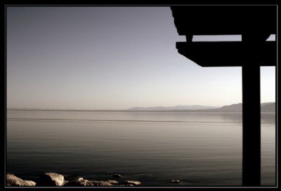
The Shot: F/16, 28 mm, ISO 100, 1 stop under. 1 round sharpenning via Picassa, and tone adjustment via tunning